Loading...
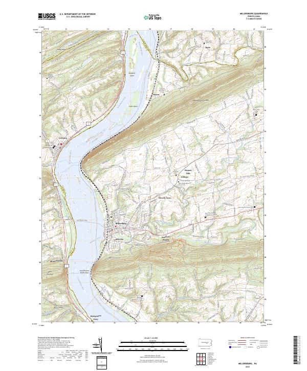
Loading map...2023 Map of Millersburg
USGS Topo · Published 2023About this map
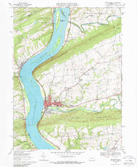
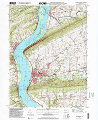
The Susquehanna River dominates this landscape at the intersection of Dauphin, Perry, Northumberland, and Juniata counties. The Millersburg Ferry remains a defining landmark, connecting Millersburg on the eastern bank to the shoreline near Liverpool to the west. This river corridor is characterized by significant topographical shifts where the water cuts through high ridges, most notably at the Susquehanna Water Gaps between Berry Mountain and Turkey Ridge.
Find a feature on this map
122 named features on this map. Tap any name to fly to it.
Don’t see what you’re looking for? This feature index may not catch every label — zoom into the map to look around manually.
Map Details
Date Portrayed2023
Date Published2023
PublisherU.S. Geological Survey
Map TypeTopographic
Scale1:24000
Physical Dimensions24 x 29 inches
Editions of this 2023 Millersburg Map
This is the sole edition of this map. No revisions or reprints were ever made.
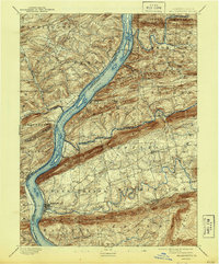
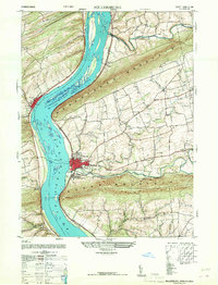
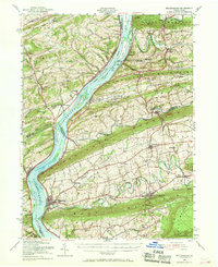
Historical Maps of Liverpool Township Through Time
8 maps found

Featured Locations
- Mifflin Township, PA
- Halifax Township, PA
- Upper Paxton Township, PA
- Liverpool Township, PA
- Lower Mahanoy Township, PA
Source Details
SourceU.S. Geological Survey
CopyrightPublic Domain