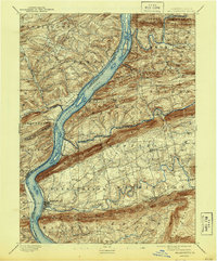
1893 Map of Millersburg
USGS Topo · Published 1944About this map
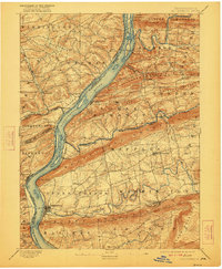
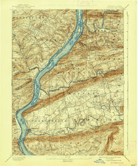
The Susquehanna River serves as the central artery for this late 19th-century landscape, where the transport infrastructure of two distinct eras is visible in parallel. The Pennsylvania Canal traces the western bank, while the Northern Central Railroad follows the eastern shore, illustrating the shift from water-borne trade to rail dominance. Settlement patterns are dictated by the dramatic ridges of Mahantango Mountain and Berry Mountain, which force towns like Millersburg and Liverpool into the fertile gaps and riverfronts. Beyond the main river corridor, numerous smaller communities such as Elizabethville, Berrysburg, and Killinger are connected by a network of rural roads traversing the valleys of Wiconisco Creek and Mahantango Creek. The map meticulously records the intersection of multiple county lines, including Dauphin, Northumberland, and Perry, highlighting the administrative complexity of this river-cut terrain during a period of steady agrarian and industrial growth.
Find a feature on this map
52 named features on this map. Tap any name to fly to it.
Don’t see what you’re looking for? This feature index may not catch every label — zoom into the map to look around manually.
Map Details
Editions of this 1893 Millersburg Map
7 editions found
Other maps of this area

1892 · Lykens
USGS Topo · 1:62,500

1892 · Hummelstown
USGS Topo · 1:62,500

1892 · Shamokin
USGS Topo · 1:62,500

1892 · Harrisburg
USGS Topo · 1:62,500

1893 · Sunbury
USGS Topo · 1:62,500

1893 · Lykens
USGS Topo · 1:62,500

1893 · Shamokin
USGS Topo · 1:62,500

1893 · Millersburg
USGS Topo · 1:62,500

1899 · Harrisburg
USGS Topo · 1:62,500

1907 · New Bloomfield
USGS Topo · 1:62,500