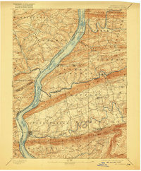
1893 Map of Millersburg
USGS Topo · Published 1917About this map
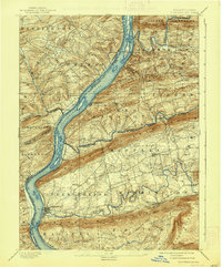
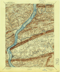
The Susquehanna River serves as the dominant artery of this region, separating several Pennsylvania counties and framing a landscape defined by parallel mountain ridges. During the late 19th century, this area was a critical transportation corridor where the Pennsylvania Canal and the Northern Central R. R. followed the river's path, facilitating the movement of coal and goods. The town of Millersburg sits at the confluence of Wiconisco Creek, while numerous smaller settlements like Dalmatia and Port Trevorton line the banks.
Find a feature on this map
58 named features on this map. Tap any name to fly to it.
Don’t see what you’re looking for? This feature index may not catch every label — zoom into the map to look around manually.
Map Details
Editions of this 1893 Millersburg Map
7 editions found
Other maps of this area

1892 · Lykens
USGS Topo · 1:62,500

1892 · Hummelstown
USGS Topo · 1:62,500

1892 · Shamokin
USGS Topo · 1:62,500

1892 · Harrisburg
USGS Topo · 1:62,500

1893 · Sunbury
USGS Topo · 1:62,500

1893 · Lykens
USGS Topo · 1:62,500

1893 · Shamokin
USGS Topo · 1:62,500

1893 · Millersburg
USGS Topo · 1:62,500

1899 · Harrisburg
USGS Topo · 1:62,500

1907 · New Bloomfield
USGS Topo · 1:62,500