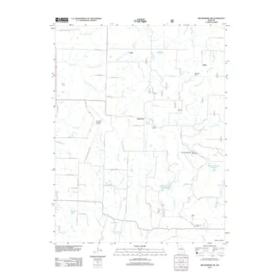
2012 Map of Millersburg SW
USGS Topo · Published 2012About this map
Englewood and the smaller settlements of Ginlet and Millers anchor this portion of Boone County, defined by a complex drainage system of creeks and reservoirs. The landscape is carved by Cedar Creek and its many tributaries, including Stump Creek and Smith Creek, creating topographical features such as Mill Site Bluff and the prominent Devils Backbone. This 2012 survey illustrates a mix of traditional rural infrastructure and modern development, where family landmarks like the Johnson Cemetery and Barger Cemetery lie just east of the expansive Columbia Regional Airport. Water management is a significant theme across the quadrangle, evidenced by the numerous reservoirs such as Ashland Lake, Peterson Lake, and the Doctor Windmiller Reservoir. The southern edge transitions toward the Audrain Prairies, while recreation is noted at the Pine Ridge Picnic Grounds and Bass Lake, showing how the land serves both utility and leisure.
Find a feature on this map
63 named features on this map. Tap any name to fly to it.
Don’t see what you’re looking for? This feature index may not catch every label — zoom into the map to look around manually.
Map Details
Editions of this 2012 Millersburg SW Map
This is the sole edition of this map. No revisions or reprints were ever made.
Other maps of this area

1886 · Jefferson City
USGS Topo · 1:125,000

1894 · Jefferson City
USGS Topo · 1:125,000

1935 · Columbia
USGS Topo · 1:24,000

1939 · Jefferson City
USGS Topo · 1:62,500

1940 · Columbia
USGS Topo · 1:24,000

1942 · Jefferson City
USGS Topo · 1:62,500

1944 · Millersburg
USGS Topo · 1:62,500

1946 · Millersburg
USGS Topo · 1:62,500

1947 · Jefferson City
USGS Topo · 1:250,000

1948 · Centertown
USGS Topo · 1:62,500