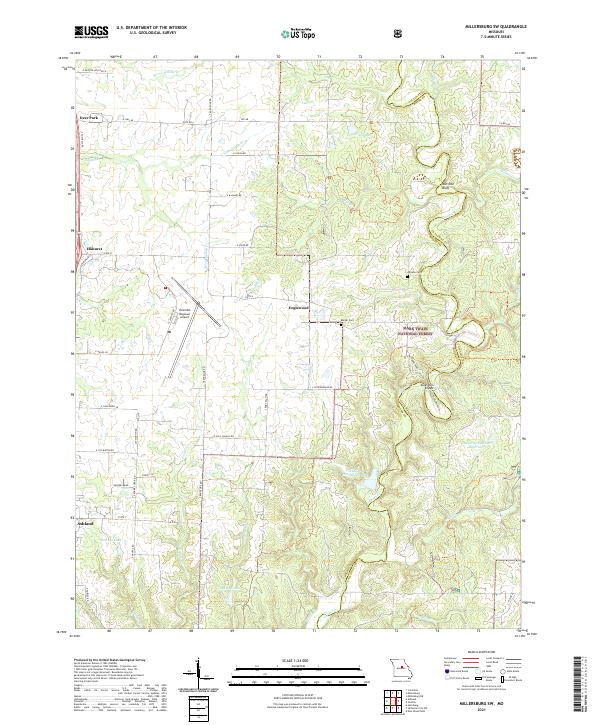
2021 Map of Millersburg SW
USGS Topo · Published 2021About this map
The Columbia Regional Airport occupies a central position in this Missouri landscape, where the modern aviation footprint meets the traditional rural terrain of southern Boone County. To the east, the Mark Twain National Forest preserves the complex drainage of Cedar Cr and Dry Fork, featuring distinctive landforms such as Devil's Backbone and the Mill Site Bluff. Small settlements like Deer Park, Englewood, and Elkhurst dot the northern and central sections, while the northern edge of Ashland appears in the southwest. Local history is anchored by the Johnson Cem and Barger Cem, situated near several private reservoirs including Eugene Windmiller Lake and Doctor Windmiller Reservoir. The map documents a transition from the structured aviation corridors of the airport to the winding, natural riparian networks of Bonne Femme Cr and its tributaries.
Find a feature on this map
62 named features on this map. Tap any name to fly to it.
Don’t see what you’re looking for? This feature index may not catch every label — zoom into the map to look around manually.
Map Details
Editions of this 2021 Millersburg SW Map
This is the sole edition of this map. No revisions or reprints were ever made.
Other maps of this area

1886 · Jefferson City
USGS Topo · 1:125,000

1894 · Jefferson City
USGS Topo · 1:125,000

1935 · Columbia
USGS Topo · 1:24,000

1939 · Jefferson City
USGS Topo · 1:62,500

1940 · Columbia
USGS Topo · 1:24,000

1942 · Jefferson City
USGS Topo · 1:62,500

1944 · Millersburg
USGS Topo · 1:62,500

1946 · Millersburg
USGS Topo · 1:62,500

1947 · Jefferson City
USGS Topo · 1:250,000

1948 · Centertown
USGS Topo · 1:62,500