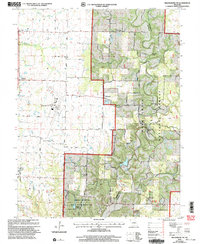
2000 Map of Millersburg SW
USGS Topo · Published 2003About this map
The rolling landscape of southern Boone County at the turn of the millennium is defined by a blend of conservation lands and regional infrastructure. Much of the eastern and southern terrain is occupied by the Mark Twain National Forest and the Baskett Wildlife Research Area, which is managed by the University of Missouri. This area features dramatic topography such as the Devils Backbone ridge and Mill Site Bluff overlooking Cedar Creek.
Find a feature on this map
60 named features on this map. Tap any name to fly to it.
Don’t see what you’re looking for? This feature index may not catch every label — zoom into the map to look around manually.
Map Details
Editions of this 2000 Millersburg SW Map
This is the sole edition of this map. No revisions or reprints were ever made.
Other maps of this area

1886 · Jefferson City
USGS Topo · 1:125,000

1894 · Jefferson City
USGS Topo · 1:125,000

1935 · Columbia
USGS Topo · 1:24,000

1939 · Jefferson City
USGS Topo · 1:62,500

1940 · Columbia
USGS Topo · 1:24,000

1942 · Jefferson City
USGS Topo · 1:62,500

1944 · Millersburg
USGS Topo · 1:62,500

1946 · Millersburg
USGS Topo · 1:62,500

1947 · Jefferson City
USGS Topo · 1:250,000

1948 · Centertown
USGS Topo · 1:62,500