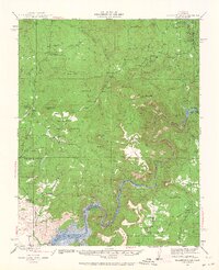
1942 Map of Millerton Lake
USGS Topo · Published 1964About this map
The San Joaquin River and the newly forming Millerton Lake dominate this 1940s landscape on the border of Madera and Fresno counties. The map documents an era of industrial transition and long-standing ranching traditions, evidenced by the numerous family-named holdings such as Veater Ranch and Lewis Ranch. Gold mining history is still visible on the terrain through the Carnation Mine and Fresno Banner Mine, while the infrastructure of the Kerckhoff Powerhouse and several Gaging Stations along the river reflect the mid-century focus on hydroelectric power and water management.
Find a feature on this map
73 named features on this map. Tap any name to fly to it.
Don’t see what you’re looking for? This feature index may not catch every label — zoom into the map to look around manually.
Map Details
Editions of this 1942 Millerton Lake Map
2 editions found

Other maps of this area

1904 · Kaiser
USGS Topo · 1:125,000

1912 · Mariposa
USGS Topo · 1:125,000

1916 · Sulphur Springs
USGS Topo · 1:24,000

1919 · Sulphur Springs
USGS Topo · 1:31,680

1919 · Little Table Mountain
USGS Topo · 1:31,680

1922 · Trimmer
USGS Topo · 1:96,000

1922 · Lanes Bridge
USGS Topo · 1:31,680

1922 · Friant
USGS Topo · 1:31,680

1923 · Academy
USGS Topo · 1:31,680

1924 · Dinuba
USGS Topo · 1:125,000