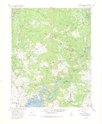
1965 Map of Millerton Lake
USGS Topo · Published 1980About this map
Millerton Lake and the winding San Joaquin River anchor this mid-1960s study of the foothills between Madera and Fresno counties. The landscape is a complex of family-run operations and early hydroelectric development, with the Kerckhoff Powerhouse and Friant Dam regulating the waters that once flowed freely through Patterson Bend. Scattered settlements like O'Neals, North Fork, and Prather serve as hubs for the surrounding ranchlands, including the Hildreth Ranch and J McDougal Ranch.
Find a feature on this map
98 named features on this map. Tap any name to fly to it.
Don’t see what you’re looking for? This feature index may not catch every label — zoom into the map to look around manually.
Map Details
Editions of this 1965 Millerton Lake Map
2 editions found
Other maps of this area

1904 · Kaiser
USGS Topo · 1:125,000

1912 · Mariposa
USGS Topo · 1:125,000

1916 · Sulphur Springs
USGS Topo · 1:24,000

1919 · Sulphur Springs
USGS Topo · 1:31,680

1919 · Little Table Mountain
USGS Topo · 1:31,680

1922 · Trimmer
USGS Topo · 1:96,000

1922 · Lanes Bridge
USGS Topo · 1:31,680

1922 · Friant
USGS Topo · 1:31,680

1923 · Academy
USGS Topo · 1:31,680

1924 · Dinuba
USGS Topo · 1:125,000