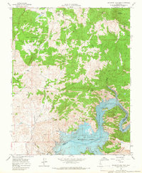
1965 Map of Millerton Lake West
USGS Topo · Published 1966About this map
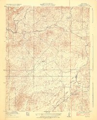
Friant Dam anchors the landscape where the San Joaquin River is impounded to form Millerton Lake, a central feature of this mid-1960s survey. The map records a complex rural environment defined by large holdings such as the J McDougal Ranch, O'Neal Ranch, and the San Joaquin Experimental Range. Local infrastructure of the era is well-documented, including the Spring Valley Sch, the Madera Canal, and a Gaging Station downstream from the dam.
Find a feature on this map
39 named features on this map. Tap any name to fly to it.
Don’t see what you’re looking for? This feature index may not catch every label — zoom into the map to look around manually.
Map Details
Editions of this 1965 Millerton Lake West Map
4 editions found
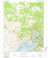
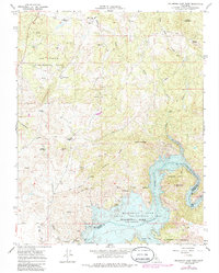

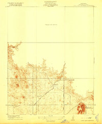
Other maps of this area

1912 · Mariposa
USGS Topo · 1:125,000

1916 · Sulphur Springs
USGS Topo · 1:24,000

1919 · Sulphur Springs
USGS Topo · 1:31,680
1919 · Little Table Mountain
USGS Topo · 1:31,680

1922 · Lanes Bridge
USGS Topo · 1:31,680

1922 · Friant
USGS Topo · 1:31,680
1923 · Academy
USGS Topo · 1:31,680

1942 · Raymond
USGS Topo · 1:62,500

1942 · Little Table Mountain
USGS Topo · 1:24,000

1942 · Millerton Lake
USGS Topo · 1:62,500