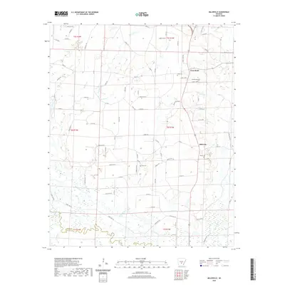
2020 Map of Millerville
USGS Topo · Published 2020About this map
The Saline River winds through the southern reaches of this landscape on the border of Grant and Dallas counties. The area is defined by a dense network of forest roads and small creek drainages, including Flat Creek and Hurricane Creek. Settlement is concentrated along the eastern corridor, where the Sheridan Bypass and various county roads connect the small communities of Millerville and Cross Roads.
Find a feature on this map
95 named features on this map. Tap any name to fly to it.
Don’t see what you’re looking for? This feature index may not catch every label — zoom into the map to look around manually.
Map Details
Editions of this 2020 Millerville Map
This is the sole edition of this map. No revisions or reprints were ever made.
Other maps of this area

1955 · Little Rock
USGS Topo · 1:250,000

1956 · Little Rock
USGS Topo · 1:250,000

1960 · Little Rock
USGS Topo · 1:250,000

1963 · Prattsville
USGS Topo · 1:24,000

1964 · Little Rock
USGS Topo · 1:250,000

1964 · Staves
USGS Topo · 1:24,000

1964 · Sheridan
USGS Topo · 1:24,000

1964 · Bunn
USGS Topo · 1:24,000
1964 · Millerville
USGS Topo · 1:24,000
1964 · Prague
USGS Topo · 1:24,000