
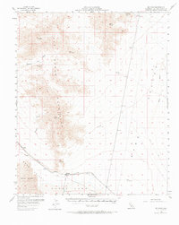
1956 Map of Milligan
USGS Topo · Published 1958About this map
The rugged Old Woman Mountains dominate the western portion of this 1950s survey, yielding to the broad expanse of Ward Valley and the dry bed of Danby Lake. This arid landscape was defined by industrial extraction and the logistics of the desert crossing, evidenced by the Atchison Topeka and Santa Fe railroad corridor. At the edge of the lake, Salt Evaporators indicate local mining activity, while the small settlement of Milligan serves as a junction point on the rail line. To the north, the isolated Lucky Jim Mine and Black Metal Mine reflect the era's prospecting efforts. Reliable water sources like Sheep Camp Spring and Spring Wilhelm were critical landmarks for travelers and miners navigating the washes, such as Homer Wash and Browns Wash, which cut through the high desert terrain.
Find a feature on this map
26 named features on this map. Tap any name to fly to it.
Don’t see what you’re looking for? This feature index may not catch every label — zoom into the map to look around manually.
Map Details
Editions of this 1956 Milligan Map
2 editions found
Other maps of this area

1942 · Amboy
USGS Topo · 1:250,000

1943 · Center Hills
USGS Topo · 1:62,500

1943 · Amboy
USGS Topo · 1:250,000

1943 · Essex
USGS Topo · 1:62,500

1943 · Danby
USGS Topo · 1:62,500

1943 · Cadiz Lake
USGS Topo · 1:62,500

1943 · Cadiz Valley
USGS Topo · 1:62,500

1943 · Turtle Mts.
USGS Topo · 1:62,500

1943 · Iron Mountains
USGS Topo · 1:62,500

1954 · Needles
USGS Topo · 1:250,000