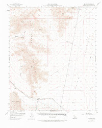
1956 Map of Milligan
USGS Topo · Published 1965About this map
Old Woman Mountains dominate the central landscape of this Mojave Desert region, where mining and rail infrastructure defined the mid-century economy. The Atchison Topeka and Santa Fe railroad cuts across the southern flats, serving the small siding of Milligan and the nearby Fishel. This transport corridor was essential for industrial operations like the Salt Evaporators situated on the edge of the Danby Lake playa.
Find a feature on this map
37 named features on this map. Tap any name to fly to it.
Don’t see what you’re looking for? This feature index may not catch every label — zoom into the map to look around manually.
Map Details
Editions of this 1956 Milligan Map
2 editions found

Other maps of this area

1942 · Amboy
USGS Topo · 1:250,000

1943 · Center Hills
USGS Topo · 1:62,500

1943 · Amboy
USGS Topo · 1:250,000

1943 · Essex
USGS Topo · 1:62,500

1943 · Danby
USGS Topo · 1:62,500

1943 · Cadiz Lake
USGS Topo · 1:62,500

1943 · Cadiz Valley
USGS Topo · 1:62,500

1943 · Turtle Mts.
USGS Topo · 1:62,500

1943 · Iron Mountains
USGS Topo · 1:62,500

1954 · Needles
USGS Topo · 1:250,000