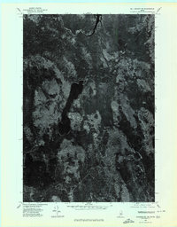
1975 Map of Millinocket SW
USGS Topo · Published 1980About this map
The Penobscot River winds through the northern portion of this orthophotoquad, serving as a primary corridor through a heavily forested landscape in Penobscot County. Unlike standard topographic sheets, this 1975 aerial perspective provides a clear view of the dense timberlands and wetland systems that define the region's wilderness character. Water dominates the interior terrain, with the prominent Nollessemic Lake situated centrally, while portions of East Branch Lake and Mattamiscontis Lake mark the southern boundaries. The lack of named roads or settlements highlights the isolation of these woods, emphasizing a landscape primarily utilized for timber resources and remote water access during the mid-1970s. This imagery offers researchers a precise record of forest cover and water levels before more modern development or natural shifts altered the shoreline and canopy.
Find a feature on this map
4 named features on this map. Tap any name to fly to it.
Don’t see what you’re looking for? This feature index may not catch every label — zoom into the map to look around manually.
Map Details
Editions of this 1975 Millinocket SW Map
2 editions found
Other maps of this area

1942 · Lincoln
USGS Topo · 1:62,500

1947 · Schoodic
USGS Topo · 1:62,500

1949 · Schoodic
USGS Topo · 1:62,500

1951 · Norcross
USGS Topo · 1:62,500

1951 · Millinocket
USGS Topo · 1:62,500

1954 · Millinocket
USGS Topo · 1:250,000

1957 · Lincoln
USGS Topo · 1:62,500

1958 · Millinocket
USGS Topo · 1:250,000

1960 · Millinocket
USGS Topo · 1:250,000

1975 · Millinocket SW
USGS Topo · 1:24,000