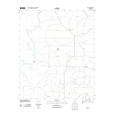
2011 Map of Milo
USGS Topo · Published 2011About this map
Saline River bottomlands dominate the western edge of this Ashley County landscape, where the meandering channel is flanked by oxbow formations like Black Lake and Old River. The transition from the river's floodplains to the higher ground of the eastern half is marked by Moffatt Bluff, providing a clear geographical divide between the dense hydrology of the west and the rural road network of the east. Settlement patterns here are tied to historic crossroads and creek crossings, illustrated by the proximity of Milo and Old Milo.
Find a feature on this map
68 named features on this map. Tap any name to fly to it.
Don’t see what you’re looking for? This feature index may not catch every label — zoom into the map to look around manually.
Map Details
Editions of this 2011 Milo Map
This is the sole edition of this map. No revisions or reprints were ever made.
Other maps of this area

1934 · Ingalls
USGS Topo · 1:48,000

1934 · Felsenthal
USGS Topo · 1:62,500

1937 · Felsenthal
USGS Topo · 1:62,500

1937 · Ingalls
USGS Topo · 1:62,500

1938 · Felsenthal
USGS Topo · 1:62,500

1939 · Felsenthal
USGS Topo · 1:62,500

1939 · Ingalls
USGS Topo · 1:62,500

1952 · Fountain Hill
USGS Topo · 1:24,000

1953 · Greenwood
USGS Topo · 1:250,000

1953 · El Dorado
USGS Topo · 1:250,000