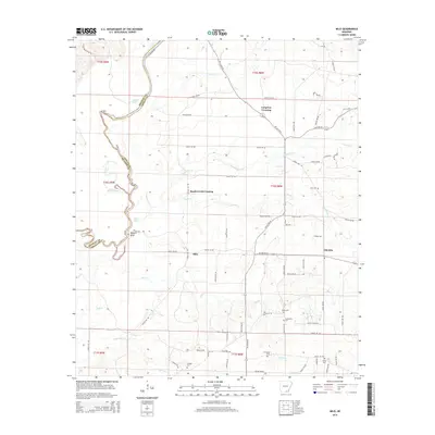
2014 Map of Milo
USGS Topo · Published 2014About this map
The Saline River defines the western border of this region, meandering alongside Moffatt Bluff and creating several oxbows including Black Lake, Old River, and Clear Lake. This landscape at the edge of Ashley County reflects a rural Arkansas character centered on small settlements and creek crossings. The map identifies Milo and Old Milo as central points, while Longview Crossing and Beech Creek Crossing highlight the importance of local transit points across the region's many waterways. Numerous family and local cemeteries are scattered throughout the quadrangle, including Zion Cem, Egypy Cem, and Walker Cem, providing a dense network of landmarks for genealogical study. The drainage patterns of Fountain Cr, Mill Cr, and Beech Cr further shape the distribution of homes and farm roads across this timber and agricultural terrain.
Find a feature on this map
77 named features on this map. Tap any name to fly to it.
Don’t see what you’re looking for? This feature index may not catch every label — zoom into the map to look around manually.
Map Details
Editions of this 2014 Milo Map
This is the sole edition of this map. No revisions or reprints were ever made.
Other maps of this area

1934 · Ingalls
USGS Topo · 1:48,000

1934 · Felsenthal
USGS Topo · 1:62,500

1937 · Felsenthal
USGS Topo · 1:62,500

1937 · Ingalls
USGS Topo · 1:62,500

1938 · Felsenthal
USGS Topo · 1:62,500

1939 · Felsenthal
USGS Topo · 1:62,500

1939 · Ingalls
USGS Topo · 1:62,500

1952 · Fountain Hill
USGS Topo · 1:24,000

1953 · Greenwood
USGS Topo · 1:250,000

1953 · El Dorado
USGS Topo · 1:250,000