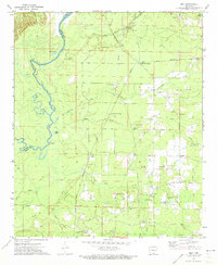
1971 Map of Milo
USGS Topo · Published 1973About this map
The meandering Saline River defines the western edge of this 1970s survey, where the river's tight oxbows and remnant channels like Old River and Black Lake create a complex floodplain landscape along the boundary of Ashley and Bradley counties. The area is characterized by a high density of rural religious and community markers, suggesting a deeply rooted local history. Small settlements such as Milo and Old Milo serve as interior anchors, connected by a network of timber and farm roads that cross numerous drainages including Fountain Creek, Beech Creek, and Mill Creek.
Find a feature on this map
31 named features on this map. Tap any name to fly to it.
Don’t see what you’re looking for? This feature index may not catch every label — zoom into the map to look around manually.
Map Details
Editions of this 1971 Milo Map
This is the sole edition of this map. No revisions or reprints were ever made.
Other maps of this area

1934 · Ingalls
USGS Topo · 1:48,000

1934 · Felsenthal
USGS Topo · 1:62,500

1937 · Felsenthal
USGS Topo · 1:62,500

1937 · Ingalls
USGS Topo · 1:62,500

1938 · Felsenthal
USGS Topo · 1:62,500

1939 · Felsenthal
USGS Topo · 1:62,500

1939 · Ingalls
USGS Topo · 1:62,500

1952 · Fountain Hill
USGS Topo · 1:24,000

1953 · Greenwood
USGS Topo · 1:250,000

1953 · El Dorado
USGS Topo · 1:250,000