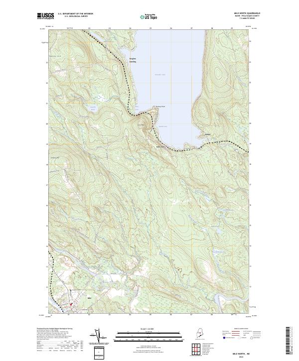
2024 Map of Milo North
USGS Topo · Published 2024About this map
Milo serves as the focal point of this Piscataquis County landscape, situated at the confluence of the Sebec River, Pleasant River, and Piscataquis River. The map illustrates a transition from the village center, marked by the Evergreen Cem and a dense network of streets like High St and Clinton St, to the more dispersed lakeside communities of the north. Significant water bodies like the expansive Schoodic Lake define the northern terrain, where small settlements such as Lake View, Adams, and Knights Landing are connected by a system of fire roads and trestles. Higher elevations such as Searles Hill and Stickney Hill overlook a patchwork of brooks and meadows, including Hawthorne Meadow and Palmer Meadow. The layout of roads like Trestle Rd and Stanfield Ridge Rd reflects a landscape shaped by both the river valleys and the prominent lake frontage.
Find a feature on this map
58 named features on this map. Tap any name to fly to it.
Don’t see what you’re looking for? This feature index may not catch every label — zoom into the map to look around manually.
Map Details
Editions of this 2024 Milo North Map
This is the sole edition of this map. No revisions or reprints were ever made.
Other maps of this area

1932 · Dover-Foxcroft
USGS Topo · 1:48,000

1933 · Boyd Lake
USGS Topo · 1:62,500

1935 · Dover-Foxcroft
USGS Topo · 1:62,500

1940 · Sebec
USGS Topo · 1:48,000

1943 · Sebec
USGS Topo · 1:62,500

1947 · Schoodic
USGS Topo · 1:62,500

1949 · Schoodic
USGS Topo · 1:62,500

1951 · Boyd Lake
USGS Topo · 1:50,000

1954 · Millinocket
USGS Topo · 1:250,000

1955 · Boyd Lake
USGS Topo · 1:62,500