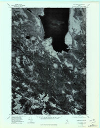
1978 Map of Milo North
USGS Topo · Published 1981About this map
Schoodic Lake dominates the northern reaches of this Piscataquis County landscape, its dark waters providing a sharp contrast to the surrounding forested terrain of the late 1970s. The settlement of Lake View sits at the southern tip of the lake, while the village of Adams occupies the eastern shore. This orthophotoquad provides an unfiltered aerial perspective of the region's complex hydrology and timberland patterns. To the south, the Pleasant River and Sebec River converge near the town of Milo, showing the natural confluence that historically dictated local settlement and industry. Smaller water bodies like Jaquith Pond and the winding course of Alder Brook further illustrate the water-rich geography of central Maine during this era of transitioning land use.
Find a feature on this map
9 named features on this map. Tap any name to fly to it.
Don’t see what you’re looking for? This feature index may not catch every label — zoom into the map to look around manually.
Map Details
Editions of this 1978 Milo North Map
This is the sole edition of this map. No revisions or reprints were ever made.
Other maps of this area

1932 · Dover-Foxcroft
USGS Topo · 1:48,000

1933 · Boyd Lake
USGS Topo · 1:62,500

1935 · Dover-Foxcroft
USGS Topo · 1:62,500

1940 · Sebec
USGS Topo · 1:48,000

1943 · Sebec
USGS Topo · 1:62,500

1947 · Schoodic
USGS Topo · 1:62,500

1949 · Schoodic
USGS Topo · 1:62,500

1951 · Boyd Lake
USGS Topo · 1:50,000

1954 · Millinocket
USGS Topo · 1:250,000

1955 · Boyd Lake
USGS Topo · 1:62,500