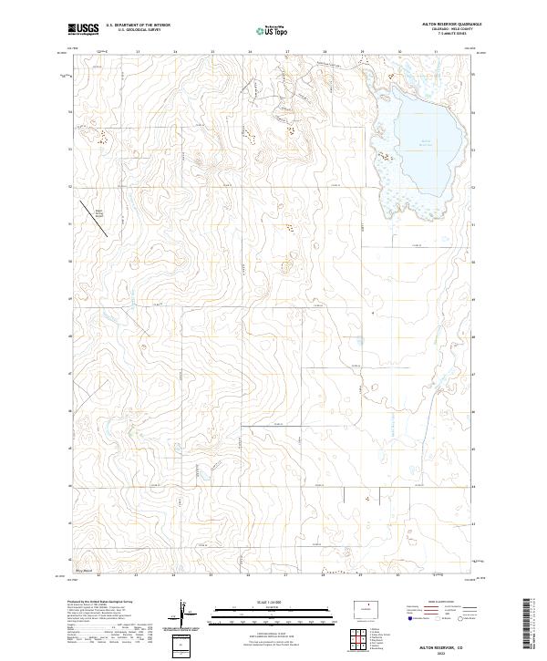
2022 Map of Milton Reservoir
USGS Topo · Published 2022About this map
Milton Reservoir dominates the northeastern landscape of this Weld County quadrangle, a vital water storage feature fed by the Evans-Number 2 Ditch and Gilmore Ditch. The surrounding terrain reflects a complex network of agricultural irrigation, with the Speer Canal—including its east and west branches—cutting through the western sections. This 2022 survey illustrates the high plains' transition into a managed water landscape, where residential developments like those along Beebe Draw Farms Pkwy and Fairbanks Rd N begin to overlay the traditional section-line grid.
Find a feature on this map
39 named features on this map. Tap any name to fly to it.
Don’t see what you’re looking for? This feature index may not catch every label — zoom into the map to look around manually.
Map Details
Editions of this 2022 Milton Reservoir Map
This is the sole edition of this map. No revisions or reprints were ever made.
Other maps of this area

1902 · Greeley
USGS Topo · 1:125,000

1949 · Fort Lupton
USGS Topo · 1:24,000

1949 · Platteville
USGS Topo · 1:24,000

1949 · Hudson
USGS Topo · 1:24,000

1950 · Platteville
USGS Topo · 1:24,000
1950 · Fort Lupton
USGS Topo · 1:24,000

1950 · Keenesburg
USGS Topo · 1:24,000

1950 · Milliken
USGS Topo · 1:24,000

1950 · Klug Ranch
USGS Topo · 1:24,000

1950 · Valley View School
USGS Topo · 1:24,000