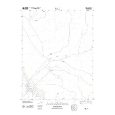
2011 Map of Mina
USGS Topo · Published 2011About this map
Mina anchors this high-desert Nevada landscape, serving as a hub for the surrounding canyons and peaks. The town layout is clearly defined by residential streets such as McArthur St and Douglas St, while infrastructure like the Mina Post Office and Mina Airport highlights its role as a regional center. The terrain is a network of arid drainages, including New York Canyon, Volcano Canyon, and Mac Canyon, all cutting through a rugged backdrop of elevations like Volcano Peak and Llama Mountain. Notable water sources, essential in this environment, include Southern Pacific Spring and Fagans Spring. The presence of the Mina Cemetery and various local routes like Simon Lead Rd and Garfield Flats Rd offer valuable context for those researching the human footprint and movement across this portion of Mineral County.
Find a feature on this map
24 named features on this map. Tap any name to fly to it.
Don’t see what you’re looking for? This feature index may not catch every label — zoom into the map to look around manually.
Map Details
Editions of this 2011 Mina Map
This is the sole edition of this map. No revisions or reprints were ever made.
Other maps of this area

1907 · Tonopah
USGS Topo · 1:250,000

1908 · Tonopah
USGS Topo · 1:250,000

1909 · Hawthorne
USGS Topo · 1:250,000

1911 · Hawthorne
USGS Topo · 1:250,000

1915 · Hawthorne
USGS Topo · 1:250,000

1948 · Walker Lake
USGS Topo · 1:250,000

1956 · Tonopah
USGS Topo · 1:250,000

1957 · Walker Lake
USGS Topo · 1:250,000

1959 · Tonopah
USGS Topo · 1:250,000

1962 · Walker Lake
USGS Topo · 1:250,000