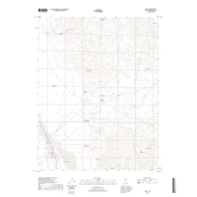
2018 Map of Mina
USGS Topo · Published 2018About this map
Mina sits at the edge of the Soda Spring Valley, serving as a focal point for this desert landscape where the Gabbs Valley Range and Pilot Mountains meet. The town's grid is clearly defined by streets like Front St and 10th St, with the Mina Cem located just to the northwest. This area reflects a history of transit and resource management in Mineral County, evidenced by the Mina Airport and the critical water sources scattered across the dry terrain, such as Southern Pacific Spring and Tule Spring. The surrounding geography is carved by numerous washes and canyons, including Cinnabar Canyon and Volcano Canyon, which suggest the mineral-rich character of the region. Local landmarks like Malapie Hill and Llama Mtn provide distinct points of reference for those tracing the historical development and topography of this Nevada desert crossroads.
Find a feature on this map
28 named features on this map. Tap any name to fly to it.
Don’t see what you’re looking for? This feature index may not catch every label — zoom into the map to look around manually.
Map Details
Editions of this 2018 Mina Map
This is the sole edition of this map. No revisions or reprints were ever made.
Other maps of this area

1907 · Tonopah
USGS Topo · 1:250,000

1908 · Tonopah
USGS Topo · 1:250,000

1909 · Hawthorne
USGS Topo · 1:250,000

1911 · Hawthorne
USGS Topo · 1:250,000

1915 · Hawthorne
USGS Topo · 1:250,000

1948 · Walker Lake
USGS Topo · 1:250,000

1956 · Tonopah
USGS Topo · 1:250,000

1957 · Walker Lake
USGS Topo · 1:250,000

1959 · Tonopah
USGS Topo · 1:250,000

1962 · Walker Lake
USGS Topo · 1:250,000