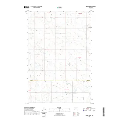
2017 Map of Mineral Springs
USGS Topo · Published 2017About this map
Mineral Springs anchors this high-plains landscape where the headwaters of the Cedar Creek drainage system begin their eastward journey. The geography is defined by the winding paths of the N Fork Cedar Cr, S Fork Cedar Cr, and the main stem of Cedar Cr, which carve subtle drainage patterns across the prairie. The terrain rises to the northeast at the Bob Denny Hills, providing a distinct vertical contrast to the surrounding section lines and grazing lands. In a region where distances are vast and infrastructure is sparse, the presence of the Dilse Private Airstrip highlights the importance of aerial access for local land management and connectivity. This 2017 survey documents the enduring rural character of the North Dakota borderlands, showing a network of section roads like 80th St SW and 137th Ave SW that maintain the strict grid of the Public Land Survey System across the county line.
Find a feature on this map
16 named features on this map. Tap any name to fly to it.
Don’t see what you’re looking for? This feature index may not catch every label — zoom into the map to look around manually.
Map Details
Editions of this 2017 Mineral Springs Map
This is the sole edition of this map. No revisions or reprints were ever made.
Other maps of this area

1953 · Dickinson
USGS Topo · 1:250,000

1957 · Dickinson
USGS Topo · 1:250,000

1969 · Scranton
USGS Topo · 1:24,000

1969 · Scranton NE
USGS Topo · 1:24,000

1973 · White Lake
USGS Topo · 1:24,000

1973 · Warnke Hill
USGS Topo · 1:24,000

1973 · Mineral Springs
USGS Topo · 1:24,000

1973 · Talbot Butte
USGS Topo · 1:24,000

1973 · Amidon SE
USGS Topo · 1:24,000

1973 · Amidon
USGS Topo · 1:24,000