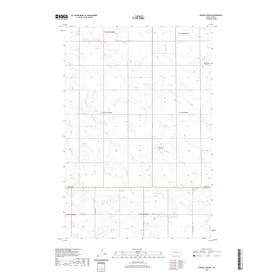
2020 Map of Mineral Springs
USGS Topo · Published 2020About this map
Mineral Springs and the surrounding prairie landscape define this corner of Slope County, where the High Plains of North Dakota are dissected by the drainage of the N Fork Cedar Cr. The terrain is characterized by broad uplands and subtle coulees, punctuated in the northeast by the Bob Denny Hills. The region is marked by a strict rectangular grid of section lines and gravel roads, including 80th St Sw and 137th Ave Sw, which serve the agricultural heartland. The presence of the Dilse Private Airstrip suggests the continued importance of aviation for large-scale ranching and land management in this sparsely populated area. Hydrologically, the map tracks the upper reaches of the Cedar Creek system, including the Cedar Cr and S Fork Cedar Cr, illustrating the vital water sources that have sustained local ranching families for generations.
Find a feature on this map
16 named features on this map. Tap any name to fly to it.
Don’t see what you’re looking for? This feature index may not catch every label — zoom into the map to look around manually.
Map Details
Editions of this 2020 Mineral Springs Map
This is the sole edition of this map. No revisions or reprints were ever made.
Other maps of this area

1953 · Dickinson
USGS Topo · 1:250,000

1957 · Dickinson
USGS Topo · 1:250,000

1969 · Scranton
USGS Topo · 1:24,000

1969 · Scranton NE
USGS Topo · 1:24,000

1973 · White Lake
USGS Topo · 1:24,000

1973 · Warnke Hill
USGS Topo · 1:24,000

1973 · Mineral Springs
USGS Topo · 1:24,000

1973 · Talbot Butte
USGS Topo · 1:24,000

1973 · Amidon SE
USGS Topo · 1:24,000

1973 · Amidon
USGS Topo · 1:24,000