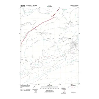
2010 Map of Minersville
USGS Topo · Published 2010About this map
Minersville serves as the central hub in this landscape of the Pennsylvania coal region, situated where the West Branch Schuylkill River flows through the valley. The map reveals a complex water management system essential to the local history, featuring numerous impoundments such as Gordon Reservoir, Crystal Reservoir, and the tiered sequence of Minersville Dam Number Four and several numbered dams along Dyer Run.
Find a feature on this map
51 named features on this map. Tap any name to fly to it.
Don’t see what you’re looking for? This feature index may not catch every label — zoom into the map to look around manually.
Map Details
Editions of this 2010 Minersville Map
This is the sole edition of this map. No revisions or reprints were ever made.
Other maps of this area

1889 · Catawissa
USGS Topo · 1:62,500

1889 · Pottsville
USGS Topo · 1:62,500

1891 · Pottsville
USGS Topo · 1:62,500

1892 · Catawissa
USGS Topo · 1:62,500

1892 · Mahanoy
USGS Topo · 1:62,500

1892 · Pine Grove
USGS Topo · 1:62,500

1893 · Mahanoy
USGS Topo · 1:62,500

1894 · Catawissa
USGS Topo · 1:62,500

1944 · Pottsville
USGS Topo · 1:24,000

1945 · Friedensburg
USGS Topo · 1:24,000