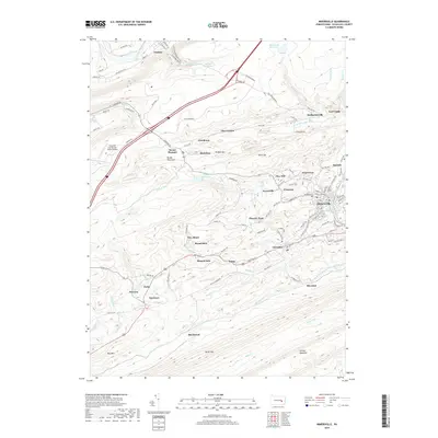
2019 Map of Minersville
USGS Topo · Published 2019About this map
Minersville and its surrounding coal-country settlements define this portion of Schuylkill County, Pennsylvania. The terrain is structured by prominent ridges such as Broad Mountain and Mine Hill, which contain narrow valleys where villages like Heckscherville, Coal Castle, and Glen Carbon were established. This 2019 survey shows a landscape heavily influenced by anthracite mining history, seen in the dense cluster of small residential centers and local infrastructure like New Mines Rd.
Find a feature on this map
113 named features on this map. Tap any name to fly to it.
Don’t see what you’re looking for? This feature index may not catch every label — zoom into the map to look around manually.
Map Details
Editions of this 2019 Minersville Map
This is the sole edition of this map. No revisions or reprints were ever made.
Other maps of this area

1889 · Catawissa
USGS Topo · 1:62,500

1889 · Pottsville
USGS Topo · 1:62,500

1891 · Pottsville
USGS Topo · 1:62,500

1892 · Catawissa
USGS Topo · 1:62,500

1892 · Mahanoy
USGS Topo · 1:62,500

1892 · Pine Grove
USGS Topo · 1:62,500

1893 · Mahanoy
USGS Topo · 1:62,500

1894 · Catawissa
USGS Topo · 1:62,500

1944 · Pottsville
USGS Topo · 1:24,000

1945 · Friedensburg
USGS Topo · 1:24,000