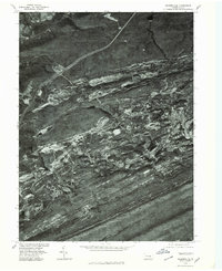
1976 Map of Minersville
USGS Topo · Published 1979About this map
Minersville and its surrounding coal-patch communities are viewed from above in this mid-1970s orthophotoquad, showing the intense surface alterations of the Southern Anthracite Field. The aerial imagery reveals the stark contrast between the dense residential grids of Llewellyn and Branch Dale and the surrounding industrial scars of mining operations. The terrain is defined by parallel ridges including Broad Mountain and Sharp Mountain, with the deep gashes of strip mines and tailing piles clearly visible between the wooded slopes. This perspective provides an unfiltered look at the intersection of human settlement and heavy industry, documenting the footprint of Buck Run and Newtown before later reclamation efforts. In the northern reaches, Mahanoy Creek winds past Gordon, marking the transition into the next valley of the coal region.
Find a feature on this map
10 named features on this map. Tap any name to fly to it.
Don’t see what you’re looking for? This feature index may not catch every label — zoom into the map to look around manually.
Map Details
Editions of this 1976 Minersville Map
This is the sole edition of this map. No revisions or reprints were ever made.
Other maps of this area

1889 · Catawissa
USGS Topo · 1:62,500

1889 · Pottsville
USGS Topo · 1:62,500

1891 · Pottsville
USGS Topo · 1:62,500

1892 · Catawissa
USGS Topo · 1:62,500

1892 · Mahanoy
USGS Topo · 1:62,500

1892 · Pine Grove
USGS Topo · 1:62,500

1893 · Mahanoy
USGS Topo · 1:62,500

1894 · Catawissa
USGS Topo · 1:62,500

1944 · Pottsville
USGS Topo · 1:24,000

1945 · Friedensburg
USGS Topo · 1:24,000