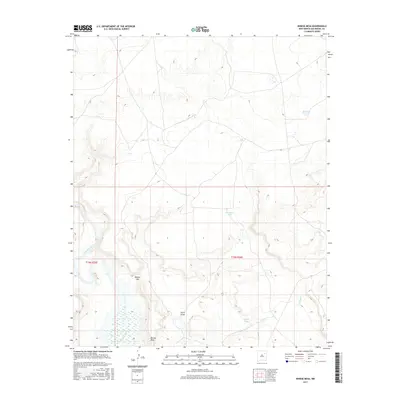
2017 Map of Minese Mesa
USGS Topo · Published 2017About this map
Minese Mesa dominates the high ground in this arid reach of San Miguel County, where the landscape is defined by the winding course of the Canadian River. This 2017 topographic survey shows a sparse ranching and grazing environment marked by critical water sources like Big Tank, Horseshoe Tank, and Diablo Tank. These cattle tanks, essential for life in the high desert, are positioned along drainage patterns like Tulosa Cr and Perra Draw. The most prominent break in the upland terrain is the Minese Gap, providing a natural passage through the mesa's edge. The map reflects a modern era of land management, detailing the grid of the Public Land Survey System including t15n r25e and t15n r26e, which organize this open range country.
Find a feature on this map
10 named features on this map. Tap any name to fly to it.
Don’t see what you’re looking for? This feature index may not catch every label — zoom into the map to look around manually.
Map Details
Editions of this 2017 Minese Mesa Map
This is the sole edition of this map. No revisions or reprints were ever made.
Other maps of this area

1954 · Santa Fe
USGS Topo · 1:250,000

1958 · Santa Fe
USGS Topo · 1:250,000

1968 · La Cinta Mesa
USGS Topo · 1:24,000

1968 · Conchas Dam
USGS Topo · 1:24,000
1972 · Bell Ranch
USGS Topo · 1:24,000

1972 · Four V Ranch
USGS Topo · 1:24,000

1972 · Arroyo Alamocito
USGS Topo · 1:24,000

1972 · Montoya Point
USGS Topo · 1:24,000

1972 · Waggoner Ranch
USGS Topo · 1:24,000

1972 · Wade Canyon
USGS Topo · 1:24,000