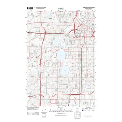
2013 Map of Minneapolis South
USGS Topo · Published 2013About this map
The Chain of Lakes and the Mississippi River dominate this urban landscape, illustrating the city's identity as a place where water and residential growth are inextricably linked. The residential neighborhoods of Kenwood Gables and the rail-side district of Glenwood Junction sit north of the major recreational waters including Lake of the Isles, Lake Calhoun, and Lake Harriet. To the northeast, the Mississippi River carves through the city center, framing historic landmarks such as Nicollet Island and Hennepin Island, which long served as the industrial heart of the region.
Find a feature on this map
64 named features on this map. Tap any name to fly to it.
Don’t see what you’re looking for? This feature index may not catch every label — zoom into the map to look around manually.
Map Details
Editions of this 2013 Minneapolis South Map
This is the sole edition of this map. No revisions or reprints were ever made.
Other maps of this area

1896 · Minneapolis
USGS Topo · 1:62,500

1896 · St. Paul
USGS Topo · 1:62,500

1901 · Minneapolis
USGS Topo · 1:62,500

1902 · White Bear
USGS Topo · 1:62,500

1902 · Anoka
USGS Topo · 1:62,500

1951 · St. Paul West
USGS Topo · 1:24,000

1951 · St. Paul SW
USGS Topo · 1:24,000

1951 · St. Paul
USGS Topo · 1:62,500

1952 · Minneapolis North
USGS Topo · 1:24,000

1952 · Minneapolis South
USGS Topo · 1:24,000