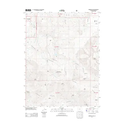
2013 Map of Minnesota Pass
USGS Topo · Published 2013About this map
Gunnison National Forest dominates this high-altitude landscape in Delta and Gunnison counties, where drainage patterns define the geography of the West Elk Mountains. A complex network of watercourses, including the N Smith Fork Gunnison River and multiple forks of Minnesota Cr, indicates a region shaped by high-country runoff. Higher elevations are marked by notable landmarks such as Mount Gunnison and the Chain Mountains, while lower mesas like Lion Mesa and Wooten Mesa provide flatter breaks in the topography.
Find a feature on this map
60 named features on this map. Tap any name to fly to it.
Don’t see what you’re looking for? This feature index may not catch every label — zoom into the map to look around manually.
Map Details
Editions of this 2013 Minnesota Pass Map
This is the sole edition of this map. No revisions or reprints were ever made.
Other maps of this area

1938 · Mt. Gunnison
USGS Topo · 1:48,000

1945 · Mount Gunnison
USGS Topo · 1:62,500

1956 · Montrose
USGS Topo · 1:250,000

1959 · Montrose
USGS Topo · 1:250,000

1960 · Montrose
USGS Topo · 1:250,000
1964 · West Beckwith Peak
USGS Topo · 1:24,000
1964 · Paonia Reservoir
USGS Topo · 1:24,000

1964 · Minnesota Pass
USGS Topo · 1:24,000
1964 · Somerset
USGS Topo · 1:24,000

1965 · Mount Guero
USGS Topo · 1:24,000