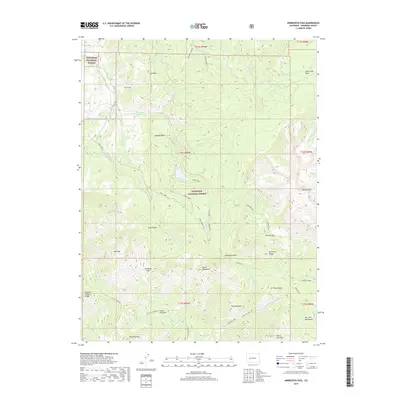
2019 Map of Minnesota Pass
USGS Topo · Published 2019About this map
Gunnison National Forest dominates this section of the West Elk Mountains in Colorado, defined by a complex network of high-altitude passes and drainage systems. The terrain is marked by prominent mesas such as Lion Mesa and Coal Creek Mesa in the north, giving way to the dramatic elevation of Mt Gunnison and the Chain Mountains further south. This landscape is a study in watershed management, where historic irrigation efforts are visible through the Deep Cr Ditch and Lone Cabin Ditch, which redirect water through the steep topography.
Find a feature on this map
55 named features on this map. Tap any name to fly to it.
Don’t see what you’re looking for? This feature index may not catch every label — zoom into the map to look around manually.
Map Details
Editions of this 2019 Minnesota Pass Map
This is the sole edition of this map. No revisions or reprints were ever made.
Other maps of this area

1938 · Mt. Gunnison
USGS Topo · 1:48,000

1945 · Mount Gunnison
USGS Topo · 1:62,500

1956 · Montrose
USGS Topo · 1:250,000

1959 · Montrose
USGS Topo · 1:250,000

1960 · Montrose
USGS Topo · 1:250,000
1964 · West Beckwith Peak
USGS Topo · 1:24,000
1964 · Paonia Reservoir
USGS Topo · 1:24,000

1964 · Minnesota Pass
USGS Topo · 1:24,000
1964 · Somerset
USGS Topo · 1:24,000

1965 · Mount Guero
USGS Topo · 1:24,000