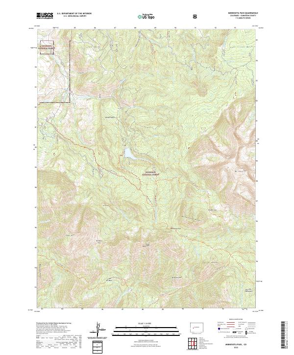
2022 Map of Minnesota Pass
USGS Topo · Published 2022About this map
The Minnesota Pass serves as a central landmark in this high-altitude landscape within the Gunnison National Forest. The map reveals a complex system of drainage and elevation, where the E Fork Minnesota Cr and S Fork Minnesota Cr carve through deep valleys between prominent plateaus like Wooten Mesa and Lion Mesa. This terrain is characterized by its significant peaks and ridges, including the Chain Mountains and the massive Mt Gunnison to the east. Historically, these lands have been managed for their natural resources and recreation, evidenced by the intricate network of pack trails such as the Lane Cabin Trl and Curecanti Trl. The presence of features like Deep Cr Ditch and Coal Creek Mesa points to a legacy of water management and mineral interest that has shaped the human footprint in the West Elk Mountains for decades.
Find a feature on this map
58 named features on this map. Tap any name to fly to it.
Don’t see what you’re looking for? This feature index may not catch every label — zoom into the map to look around manually.
Map Details
Editions of this 2022 Minnesota Pass Map
This is the sole edition of this map. No revisions or reprints were ever made.
Other maps of this area

1938 · Mt. Gunnison
USGS Topo · 1:48,000

1945 · Mount Gunnison
USGS Topo · 1:62,500

1956 · Montrose
USGS Topo · 1:250,000

1959 · Montrose
USGS Topo · 1:250,000

1960 · Montrose
USGS Topo · 1:250,000
1964 · West Beckwith Peak
USGS Topo · 1:24,000
1964 · Paonia Reservoir
USGS Topo · 1:24,000

1964 · Minnesota Pass
USGS Topo · 1:24,000
1964 · Somerset
USGS Topo · 1:24,000

1965 · Mount Guero
USGS Topo · 1:24,000