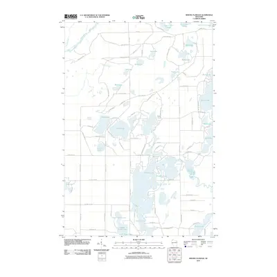
2010 Map of Minong Flowage
USGS Topo · Published 2010About this map
Glacial lake clusters and winding waterways define this northern Wisconsin landscape as it appeared in 2010. The Saint Croix Flowage and Saint Croix River dominate the northern portion of the quadrangle, while the Totagatic River snakes through the southeastern corner. This area is characterized by an intricate network of water bodies, ranging from the large Cranberry Lake and Bardon Lake to the interconnected chain of Upper Kimball Lake, Middle Kimball Lake, and Lower Kimball Lake. Small creeks like Sheosh Creek and Buckley Creek drain the surrounding timberlands, feeding into the primary river systems.
Find a feature on this map
84 named features on this map. Tap any name to fly to it.
Don’t see what you’re looking for? This feature index may not catch every label — zoom into the map to look around manually.
Map Details
Editions of this 2010 Minong Flowage Map
This is the sole edition of this map. No revisions or reprints were ever made.
Other maps of this area

1945 · Solon Springs
USGS Topo · 1:48,000

1947 · Minong
USGS Topo · 1:48,000

1949 · Solon Springs
USGS Topo · 1:48,000

1949 · Minong
USGS Topo · 1:48,000

1949 · Webb Lake
USGS Topo · 1:48,000

1949 · Patzau
USGS Topo · 1:48,000

1953 · Ashland
USGS Topo · 1:250,000

1953 · Duluth
USGS Topo · 1:250,000

1955 · Webb Lake
USGS Topo · 1:62,500

1955 · Patzau
USGS Topo · 1:62,500