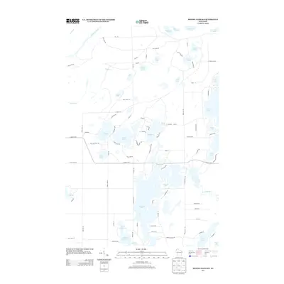
2013 Map of Minong Flowage
USGS Topo · Published 2013About this map
The Saint Croix River and Totagatic River define this Northwoods landscape, feeding into a complex network of water bodies dominated by the multi-lobed Cranberry Lake. As it appeared in 2013, the region shows a dense concentration of recreational and residential development concentrated around clear-water features like Crystal Lake and the Kimball lake chain, including Upper Kimball Lake, Middle Kimball Lake, and Lower Kimball Lake. The infrastructure of the area is characterized by a winding web of access roads such as E County Hwy-T and Bear Track Rd, which connect various landings and seasonal homes to the waterfronts. The map highlights the significant extent of the Saint Croix Flowage in the north and the isolated reaches of Webb Lake and Spider Lake, illustrating the transition from managed flowages to natural kettle lakes common in this part of Douglas County.
Find a feature on this map
82 named features on this map. Tap any name to fly to it.
Don’t see what you’re looking for? This feature index may not catch every label — zoom into the map to look around manually.
Map Details
Editions of this 2013 Minong Flowage Map
This is the sole edition of this map. No revisions or reprints were ever made.
Other maps of this area

1945 · Solon Springs
USGS Topo · 1:48,000

1947 · Minong
USGS Topo · 1:48,000

1949 · Solon Springs
USGS Topo · 1:48,000

1949 · Minong
USGS Topo · 1:48,000

1949 · Webb Lake
USGS Topo · 1:48,000

1949 · Patzau
USGS Topo · 1:48,000

1953 · Ashland
USGS Topo · 1:250,000

1953 · Duluth
USGS Topo · 1:250,000

1955 · Webb Lake
USGS Topo · 1:62,500

1955 · Patzau
USGS Topo · 1:62,500