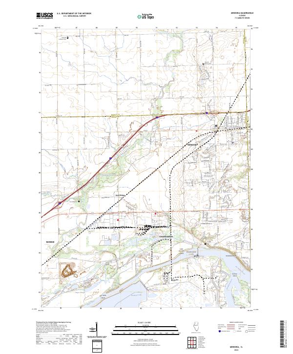
2024 Map of Minooka
USGS Topo · Published 2024About this map
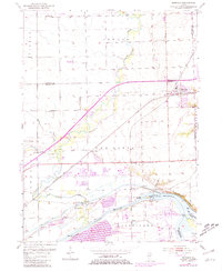
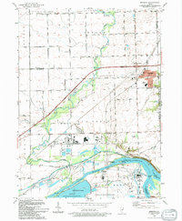
The confluence of the Illinois River, Kankakee River, and Des Plaines River defines this landscape, where the borders of Kendall, Grundy, and Will counties converge. The area around Minooka and Channahon shows a complex network of waterways, featuring Heidecke Lake and several prominent islands such as Aux Sable Island and Skinner Island. The terrain is marked by distinctive elevations like Sand Ridge and the Kankakee Bluffs, while the rural outskirts are dotted with local historical markers including Plattville Lutheran Cem and the Seward Mound Cem. The settlement pattern follows the natural courses of Aux Sable Creek and Walley Run, reflecting the industrial and agricultural integration common in this river-rich corridor of Illinois. From the residential expansion in Minooka to the managed waters of Dresden Island, the map captures the modern character of these historic river towns.
Find a feature on this map
121 named features on this map. Tap any name to fly to it.
Don’t see what you’re looking for? This feature index may not catch every label — zoom into the map to look around manually.
Map Details
Editions of this 2024 Minooka Map
This is the sole edition of this map. No revisions or reprints were ever made.