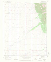
1968 Map of Mirage
USGS Topo · Published 1970About this map
Mirage sits at the edge of the San Luis Valley, where an extensive network of irrigation ditches like the Shellabarger Eaton Ditch and Wales Travis Ditch divert water from the eastern peaks toward the agricultural flats. This 1968 study documents the transition from the forested heights of the Rio Grande National Forest down to the valley floor, where the landscape is defined by flowing wells and gravity-fed water systems. Local history is anchored by the Mirage Cem and the Cemetery (Rito Alto Ch), indicating the presence of established rural communities and religious centers. The map also traces an Old Railroad Grade running parallel to San Luis Creek, a remnant of the region's earlier transportation infrastructure. Water features dominate the terrain, from the Wild Cherry Creek in the mountains to the Rito Alto Creek that winds across the plains.
Find a feature on this map
27 named features on this map. Tap any name to fly to it.
Don’t see what you’re looking for? This feature index may not catch every label — zoom into the map to look around manually.
Map Details
Editions of this 1968 Mirage Map
2 editions found
Other maps of this area

1950 · Valley View Hot Springs
USGS Topo · 1:24,000

1954 · Trinidad
USGS Topo · 1:250,000

1954 · Pueblo
USGS Topo · 1:250,000

1955 · Trinidad
USGS Topo · 1:250,000

1957 · Pueblo
USGS Topo · 1:250,000

1958 · Trinidad
USGS Topo · 1:250,000

1958 · Pueblo
USGS Topo · 1:250,000

1959 · Trinidad
USGS Topo · 1:250,000

1959 · Electric Peak
USGS Topo · 1:62,500

1962 · Pueblo
USGS Topo · 1:250,000