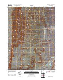
2011 Map of Miranda Flat SE
USGS Topo · Published 2011About this map
Harney County's high desert landscape is defined by its subtle drainage patterns and isolated water sources in this 2011 survey. The terrain is largely characterized by intermittent watercourses that carve through the arid basin, highlighting the critical importance of reliable water points for livestock and land management in Eastern Oregon. A primary landmark in the southeastern portion of this quadrangle is the Lower Willow Creek Waterhole, a focal point for local ranching operations and wildlife in an otherwise dry environment. The network of light-duty roads and tracks throughout the area reflects the expansive, sparsely populated nature of the region, where access is dictated by the natural flow of the land and its limited perennial water resources.
Find a feature on this map
1 named feature on this map. Tap any name to fly to it.
Don’t see what you’re looking for? This feature index may not catch every label — zoom into the map to look around manually.
Map Details
Editions of this 2011 Miranda Flat SE Map
This is the sole edition of this map. No revisions or reprints were ever made.
Other maps of this area

1955 · Adel
USGS Topo · 1:250,000

1957 · Adel
USGS Topo · 1:250,000

1958 · Adel
USGS Topo · 1:250,000

1962 · Adel
USGS Topo · 1:250,000

1981 · Coyote Lake West
USGS Topo · 1:24,000

1981 · Tule Springs
USGS Topo · 1:24,000

1981 · Tule Springs NE
USGS Topo · 1:24,000

1981 · Ancient Lake Well
USGS Topo · 1:24,000

1981 · Miranda Flat SW
USGS Topo · 1:24,000

1981 · Miranda Flat SE
USGS Topo · 1:24,000