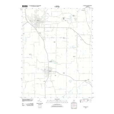
2010 Map of Mitchell
USGS Topo · Published 2010About this map
The Mitchell and Orleans corridor of southern Indiana is meticulously detailed in this 2010 survey, showcasing the region's unique karst topography and rural development. The landscape is characterized by several distinct hollows such as McKnight Hollow and Rutherford Hollow, while the Lost River meanders across the southern portion of the sheet. Notable cultural sites include Spring Mill Village and the associated Spring Mill Park Lake Dam, providing a clear view of the area's recreational and historical layout. Local heritage is further documented through numerous burial grounds, including the Hamer Cemetery, Freedom Cemetery, and Fairview Cemetery. The agricultural and research significance of the area is highlighted by the Purdue Experimental Orchard, situated between the primary settlements. This map also tracks essential infrastructure like the Orleans Airport and the Orleans Water Works Reservoir, illustrating the modern water management and transportation network of the county.
Find a feature on this map
78 named features on this map. Tap any name to fly to it.
Don’t see what you’re looking for? This feature index may not catch every label — zoom into the map to look around manually.
Map Details
Editions of this 2010 Mitchell Map
This is the sole edition of this map. No revisions or reprints were ever made.
Other maps of this area

1934 · Bedford
USGS Topo · 1:48,000

1935 · Oolitic
USGS Topo · 1:48,000

1937 · Bedford
USGS Topo · 1:62,500

1942 · Oolitic
USGS Topo · 1:62,500

1949 · Georgia
USGS Topo · 1:24,000

1950 · Mitchell
USGS Topo · 1:24,000

1951 · French Lick
USGS Topo · 1:24,000

1951 · Georgia
USGS Topo · 1:24,000

1956 · Vincennes
USGS Topo · 1:250,000

1957 · Vincennes
USGS Topo · 1:250,000