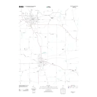
2013 Map of Mitchell
USGS Topo · Published 2013About this map
Mitchell and Orleans anchor this section of southern Indiana, illustrating the intersection of long-established agricultural lands and local industry. The map documents a diverse landscape, from the institutional grounds of the Purdue Experimental Orchard to recreational landmarks like the Holiday Drive-In and Pilgrim Campground. Near the center of the sheet, the Orleans Water Works Reservoir and the drainage toward Herron Hollow highlight the local topography and water management. To the east, Spring Mill Village sits near the headwaters of Mill Creek, reflecting the area's early settlement patterns. Further south, the course of the Lost River winds through rural tracts near River View Farms and Crandall Farms, while various topographic depressions such as Rutherford Hollow and McKnight Hollow characterize the karst-influenced terrain of Lawrence County.
Find a feature on this map
148 named features on this map. Tap any name to fly to it.
Don’t see what you’re looking for? This feature index may not catch every label — zoom into the map to look around manually.
Map Details
Editions of this 2013 Mitchell Map
This is the sole edition of this map. No revisions or reprints were ever made.
Other maps of this area

1934 · Bedford
USGS Topo · 1:48,000

1935 · Oolitic
USGS Topo · 1:48,000

1937 · Bedford
USGS Topo · 1:62,500

1942 · Oolitic
USGS Topo · 1:62,500

1949 · Georgia
USGS Topo · 1:24,000

1950 · Mitchell
USGS Topo · 1:24,000

1951 · French Lick
USGS Topo · 1:24,000

1951 · Georgia
USGS Topo · 1:24,000

1956 · Vincennes
USGS Topo · 1:250,000

1957 · Vincennes
USGS Topo · 1:250,000