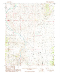
1989 Map of Mitchell Spring
USGS Topo · Published 1989About this map
The East Walker River carves a path through this high-desert landscape on the border of Lyon and Mineral Counties. The area is characterized by significant mining activity and ranching history, with the Flying M Ranch situated along the river's course. Numerous mining sites are documented across the terrain, including a Mine Shaft & Adits and various standalone prospects, signaling the region's enduring connection to extraction. A traditional Pack Trail winds through the hills, while the western portion of the map is protected within the Toiyabe National Forest. This 1989 provisional survey captures the intersection of public land management and private industry, where seasonal waterways like Rattlesnake Creek flow toward the river, and reliable water sources like Mitchell Spring remain vital landmarks in the arid environment.
Find a feature on this map
18 named features on this map. Tap any name to fly to it.
Don’t see what you’re looking for? This feature index may not catch every label — zoom into the map to look around manually.
Map Details
Editions of this 1989 Mitchell Spring Map
This is the sole edition of this map. No revisions or reprints were ever made.
Other maps of this area

1891 · Wellington
USGS Topo · 1:125,000

1893 · Wellington
USGS Topo · 1:125,000

1909 · Hawthorne
USGS Topo · 1:250,000

1909 · Bridgeport
USGS Topo · 1:125,000

1911 · Bridgeport
USGS Topo · 1:125,000

1911 · Hawthorne
USGS Topo · 1:250,000

1915 · Hawthorne
USGS Topo · 1:250,000

1920 · Bridgeport
USGS Topo · 1:125,000

1948 · Walker Lake
USGS Topo · 1:250,000

1956 · Mt. Grant
USGS Topo · 1:62,500