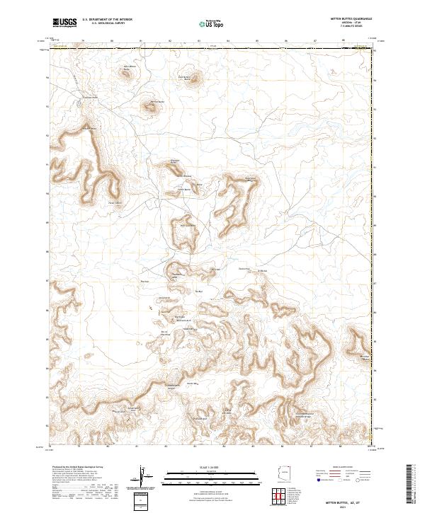
2021 Map of Mitten Buttes
USGS Topo · Published 2021About this map
The borderlands of the Utah Arizona state line define this high-desert landscape, anchored by the iconic formations of West Mitten Butte and East Mitten Butte. Surveyed in 2021, the map captures the concentration of geological features within the tribal lands of Navajo County. Beyond the well-known skyline of Merrick Butte and the Three Sisters, the sheet reveals a dense network of natural arches and formations such as Spiderweb Arch, Suns Eye, and Eye of the Dove.
Find a feature on this map
41 named features on this map. Tap any name to fly to it.
Don’t see what you’re looking for? This feature index may not catch every label — zoom into the map to look around manually.
Map Details
Editions of this 2021 Mitten Buttes Map
This is the sole edition of this map. No revisions or reprints were ever made.
Other maps of this area

1883 · Marsh Pass
USGS Topo · 1:250,000

1886 · Henry Mountains
USGS Topo · 1:250,000

1886 · Abajo
USGS Topo · 1:250,000

1892 · Marsh Pass
USGS Topo · 1:250,000

1892 · Abajo
USGS Topo · 1:250,000

1892 · Henry Mountains
USGS Topo · 1:250,000

1892 · Canyon De Chelly
USGS Topo · 1:250,000

1893 · Abajo
USGS Topo · 1:250,000

1952 · Clay Hills 4 SW
USGS Topo · 1:24,000

1952 · Agathla Peak 1 NW
USGS Topo · 1:24,000