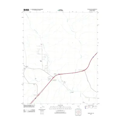
2012 Map of Moapa East
USGS Topo · Published 2012About this map
Meadow Valley Wash and the Muddy River converge in this desert landscape, defining the settlement patterns of the Moapa Valley. This 2012 survey illustrates a mix of industrial and agricultural activity, anchored by the White Star Plaster Mill and several family-named ranching operations like Powers Ranch, Searles Ranch, and West Ranch. The town centers of Moapa Town, Glendale, and Moapa are documented alongside specialized infrastructure, including the Moapa Post Office and Hupton Post Office. The road network is highly developed, featuring modern connections like the Logandale Overton Interchange and the Hidden Valley Interchange, while local residential streets such as S Henrie Rd and Casaby Ave carve out the residential footprint. The terrain remains largely open, with the Weiser Wash drainage system and The Narrows providing significant geographical boundaries in this arid region.
Find a feature on this map
30 named features on this map. Tap any name to fly to it.
Don’t see what you’re looking for? This feature index may not catch every label — zoom into the map to look around manually.
Map Details
Editions of this 2012 Moapa East Map
This is the sole edition of this map. No revisions or reprints were ever made.
Other maps of this area

1886 · Saint Thomas
USGS Topo · 1:250,000

1893 · Saint Thomas
USGS Topo · 1:250,000

1954 · Las Vegas
USGS Topo · 1:250,000

1957 · Las Vegas
USGS Topo · 1:250,000

1958 · Moapa
USGS Topo · 1:62,500

1958 · Overton
USGS Topo · 1:62,500

1959 · Las Vegas
USGS Topo · 1:250,000

1962 · Las Vegas
USGS Topo · 1:250,000

1969 · Farrier
USGS Topo · 1:24,000
1969 · Rox SE
USGS Topo · 1:24,000