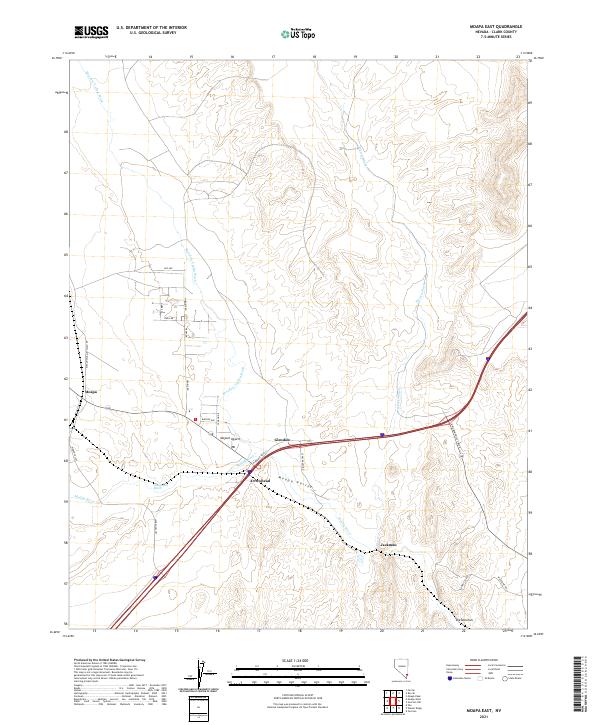
2021 Map of Moapa East
USGS Topo · Published 2021About this map
Moapa Valley serves as a critical desert corridor where the Muddy River meets the drainages of the Meadow Valley Wash. This 2021 survey illustrates the modern intersections of regional transport and desert geography, specifically where Glendale and Arrowhead sit at the junction of major transit routes. The landscape is defined by its dramatic hydrology, featuring seasonal channels like Weiser Wash and California Wash that carve through the Mojave Desert floor toward the river.
Find a feature on this map
29 named features on this map. Tap any name to fly to it.
Don’t see what you’re looking for? This feature index may not catch every label — zoom into the map to look around manually.
Map Details
Editions of this 2021 Moapa East Map
This is the sole edition of this map. No revisions or reprints were ever made.
Other maps of this area

1886 · Saint Thomas
USGS Topo · 1:250,000

1893 · Saint Thomas
USGS Topo · 1:250,000

1954 · Las Vegas
USGS Topo · 1:250,000

1957 · Las Vegas
USGS Topo · 1:250,000

1958 · Moapa
USGS Topo · 1:62,500

1958 · Overton
USGS Topo · 1:62,500

1959 · Las Vegas
USGS Topo · 1:250,000

1962 · Las Vegas
USGS Topo · 1:250,000

1969 · Farrier
USGS Topo · 1:24,000
1969 · Rox SE
USGS Topo · 1:24,000