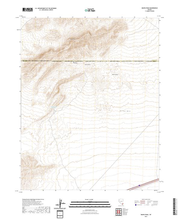
2021 Map of Moapa Peak
USGS Topo · Published 2021About this map
Moapa Peak stands as the primary landmark in this section of the Mormon Mountains, where the high desert terrain transitions toward the vast Mojave Desert. The map reveals a landscape defined by significant elevation changes and natural basins, such as Jacks Pockets and the expansive Mormon Mesa to the southeast. Water management in this arid environment is represented by the Sheep Canyon Reservoir, a critical hydrological feature located below the western slopes. This survey provides a modern view of the Clark and Lincoln county line, illustrating the remote character of southern Nevada's topography where sparse infrastructure meets the formidable geology of the Great Basin's edge.
Find a feature on this map
13 named features on this map. Tap any name to fly to it.
Don’t see what you’re looking for? This feature index may not catch every label — zoom into the map to look around manually.
Map Details
Editions of this 2021 Moapa Peak Map
This is the sole edition of this map. No revisions or reprints were ever made.
Other maps of this area

1886 · Saint Thomas
USGS Topo · 1:250,000

1893 · Saint Thomas
USGS Topo · 1:250,000

1954 · Las Vegas
USGS Topo · 1:250,000

1957 · Las Vegas
USGS Topo · 1:250,000

1958 · Moapa
USGS Topo · 1:62,500

1958 · Overton
USGS Topo · 1:62,500

1959 · Las Vegas
USGS Topo · 1:250,000

1962 · Las Vegas
USGS Topo · 1:250,000
1969 · Rox NE
USGS Topo · 1:24,000
1969 · Rox SE
USGS Topo · 1:24,000