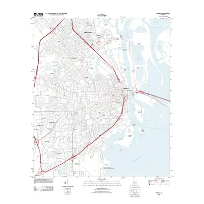
2011 Map of Mobile
USGS Topo · Published 2011About this map
Mobile's urban and industrial core is documented here along the Mobile River and Mobile Bay waterfront. The concentration of sacred sites and municipal infrastructure is particularly striking, featuring the historic Magnolia Cemetery, Mobile National Cemetery, and Church Street Cemetery within the city's established grid. The landscape transitions from the dense commercial center, marked by the Battle House Tower, to the massive transportation and logistics corridors of the Alabama State Docks and the Brookley Airport complex. Transportation links connecting the city to Blakeley Island and Pinto Island are clearly visible, including both the Bankhead Tunnel and the George C Wallace Tunnel. Further inland, the map shows the growth of residential and commercial districts such as Toulminville, Crichton, and Brookwood.
Find a feature on this map
121 named features on this map. Tap any name to fly to it.
Don’t see what you’re looking for? This feature index may not catch every label — zoom into the map to look around manually.
Map Details
Editions of this 2011 Mobile Map
This is the sole edition of this map. No revisions or reprints were ever made.
Other maps of this area

1921 · Fairhope
USGS Topo · 1:62,500

1922 · Mobile
USGS Topo · 1:62,500

1939 · Daphne
USGS Topo · 1:31,680

1940 · Hollingers Island
USGS Topo · 1:31,680

1940 · Mobile
USGS Topo · 1:31,680

1940 · Mobile
USGS Topo · 1:62,500

1941 · Chickasaw
USGS Topo · 1:31,680

1941 · Daphne
USGS Topo · 1:31,680

1941 · Blakeley
USGS Topo · 1:31,680

1941 · Bay Minette
USGS Topo · 1:62,500