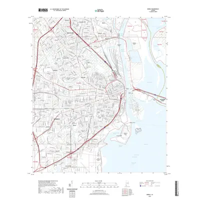
2020 Map of Mobile
USGS Topo · Published 2020About this map
Mobile anchors this complex coastal landscape where the Mobile River meets the bay, illustrating a dense urban fabric intertwined with maritime industry. Significant historical and genealogical sites are clustered throughout the city, including the sprawling grounds of Magnolia Cemetery, the Mobile National Cemetery, and the Catholic Cemetery. To the north, the industrial character of Plateau, Magazine, and Prichard is evident along the rail and river corridors, while the eastern edge is defined by the islands and reaches of the delta, such as Blakely Island and Pinto Island.
Find a feature on this map
70 named features on this map. Tap any name to fly to it.
Don’t see what you’re looking for? This feature index may not catch every label — zoom into the map to look around manually.
Map Details
Editions of this 2020 Mobile Map
This is the sole edition of this map. No revisions or reprints were ever made.
Other maps of this area

1921 · Fairhope
USGS Topo · 1:62,500

1922 · Mobile
USGS Topo · 1:62,500

1939 · Daphne
USGS Topo · 1:31,680

1940 · Hollingers Island
USGS Topo · 1:31,680

1940 · Mobile
USGS Topo · 1:31,680

1940 · Mobile
USGS Topo · 1:62,500

1941 · Chickasaw
USGS Topo · 1:31,680

1941 · Daphne
USGS Topo · 1:31,680

1941 · Blakeley
USGS Topo · 1:31,680

1941 · Bay Minette
USGS Topo · 1:62,500