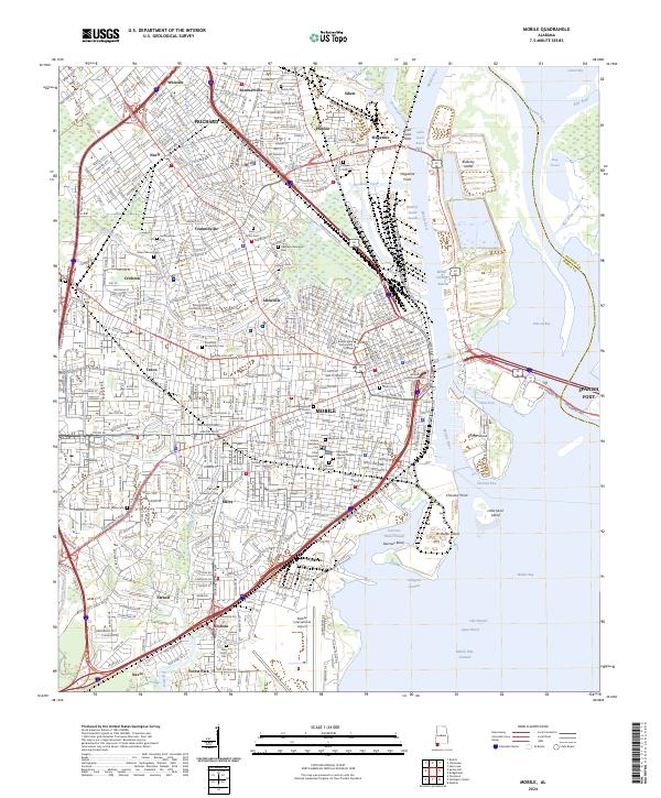
2024 Map of Mobile
USGS Topo · Published 2024About this map
Mobile sits at the head of Mobile Bay, where a complex network of waterways including the Mobile River, Spanish River, and Chickasaw Creek meet the coast. This modern survey illustrates the industrial and maritime infrastructure of the city, from the Alabama State Docks RR serving the Blakely Island reach to the Mobile International Airport in the south. The city's cultural and funerary history is deeply etched into the landscape, evidenced by a dense concentration of historic grounds such as the Mobile National Cem, Magnolia Cem, and Springhill Avenue Temple Cem.
Find a feature on this map
76 named features on this map. Tap any name to fly to it.
Don’t see what you’re looking for? This feature index may not catch every label — zoom into the map to look around manually.
Map Details
Editions of this 2024 Mobile Map
This is the sole edition of this map. No revisions or reprints were ever made.
Other maps of this area

1921 · Fairhope
USGS Topo · 1:62,500

1922 · Mobile
USGS Topo · 1:62,500

1939 · Daphne
USGS Topo · 1:31,680

1940 · Hollingers Island
USGS Topo · 1:31,680

1940 · Mobile
USGS Topo · 1:31,680

1940 · Mobile
USGS Topo · 1:62,500

1941 · Chickasaw
USGS Topo · 1:31,680

1941 · Daphne
USGS Topo · 1:31,680

1941 · Blakeley
USGS Topo · 1:31,680

1941 · Bay Minette
USGS Topo · 1:62,500