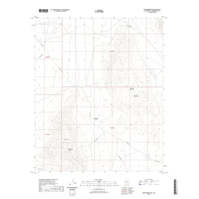
2020 Map of Mockingbird Gap
USGS Topo · Published 2020About this map
Mockingbird Gap serves as a critical geographic passage between the Little Burro Mountains and the Oscura Gap in this high-desert region of New Mexico. The landscape is characterized by its reliance on isolated water sources such as Mockingbird Spring, Babers Tank, and Mountain Tanks, which were historically essential for survival and livestock in the arid terrain. The map details a network of specialized routes, including WSMR P Route 7 and WSMR S Route 324, which navigate the rugged southern approach to the San Andres Mountains. This 2020 survey illustrates the intersection of traditional land names with the infrastructure of modern land management, highlighting the continued importance of the Mockingbird Mountains and Little Burro as regional landmarks.
Find a feature on this map
19 named features on this map. Tap any name to fly to it.
Don’t see what you’re looking for? This feature index may not catch every label — zoom into the map to look around manually.
Map Details
Editions of this 2020 Mockingbird Gap Map
This is the sole edition of this map. No revisions or reprints were ever made.
Other maps of this area

1916 · Salinas Peak
USGS Topo · 1:125,000

1916 · Tularosa
USGS Topo · 1:125,000

1918 · Oscura Peak
USGS Topo · 1:125,000

1947 · Capitol Peak
USGS Topo · 1:62,500

1948 · Granjean Well
USGS Topo · 1:62,500

1948 · Mockingbird Gap
USGS Topo · 1:62,500

1948 · Salinas Peak
USGS Topo · 1:62,500

1954 · Tularosa
USGS Topo · 1:250,000

1958 · Tularosa
USGS Topo · 1:250,000

1981 · Fairview Mountain
USGS Topo · 1:24,000