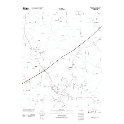
2013 Map of Mocksville
USGS Topo · Published 2013About this map
The town of Mocksville serves as the focal point of this Piedmont landscape, situated where local drainage systems like Bear Cr and Elisha Cr begin their descent toward the Yadkin River basin. The map reveals a transition between concentrated municipal development and established rural communities such as Cana and Smith Grove. Aviation history is represented by the presence of Sugar Valley Airport and Boyd's Hawks Creek Airport, reflecting the region's mid-century expansion into private and recreational flight. Smaller, perhaps older enclaves like Booetown and Nelson appear near the outskirts of the primary settlement, while Mocksville Lake provides a notable local water feature. The survey captures the intricate network of secondary routes, including Pudding Ridge Rd and Eatons Church Rd, which trace the historical movement of settlers and commerce through Davie County.
Find a feature on this map
214 named features on this map. Tap any name to fly to it.
Don’t see what you’re looking for? This feature index may not catch every label — zoom into the map to look around manually.
Map Details
Editions of this 2013 Mocksville Map
This is the sole edition of this map. No revisions or reprints were ever made.
Other maps of this area

1891 · Yadkinville
USGS Topo · 1:125,000

1893 · Statesville
USGS Topo · 1:125,000

1893 · Yadkinville
USGS Topo · 1:125,000

1950 · Churchland
USGS Topo · 1:24,000

1951 · Churchland
USGS Topo · 1:24,000

1953 · Charlotte
USGS Topo · 1:250,000

1953 · Winston-Salem
USGS Topo · 1:250,000

1954 · Charlotte
USGS Topo · 1:250,000

1955 · Winston-Salem
USGS Topo · 1:250,000

1960 · Charlotte
USGS Topo · 1:250,000