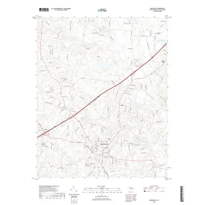
2019 Map of Mocksville
USGS Topo · Published 2019About this map
Mocksville serves as the central hub of this landscape, where the local street grid intersects with regional corridors. The town's historical geography is anchored by sites like Joppa Cem and Rose Cemetery, while modern infrastructure includes the Mocksville Lake reservoir. The surrounding Piedmont terrain is defined by a dense network of watercourses, including Dutchman Creek, Frost Mill Cr, and Becks Spring Br, which likely powered early industry and shaped the settlement patterns of outlying communities such as Cana, Center, and Smith Grove. Small-scale aviation also leaves its mark on the land with Sugar Valley Airport and Boyd's Hawks Creek Airport situated amidst the rolling hills. The naming conventions of local roads, such as Chal Smith Rd and Paul Eaton Rd, reflect the deep-rooted family history characteristic of this part of North Carolina.
Find a feature on this map
173 named features on this map. Tap any name to fly to it.
Don’t see what you’re looking for? This feature index may not catch every label — zoom into the map to look around manually.
Map Details
Editions of this 2019 Mocksville Map
This is the sole edition of this map. No revisions or reprints were ever made.
Other maps of this area

1891 · Yadkinville
USGS Topo · 1:125,000

1893 · Statesville
USGS Topo · 1:125,000

1893 · Yadkinville
USGS Topo · 1:125,000

1950 · Churchland
USGS Topo · 1:24,000

1951 · Churchland
USGS Topo · 1:24,000

1953 · Charlotte
USGS Topo · 1:250,000

1953 · Winston-Salem
USGS Topo · 1:250,000

1954 · Charlotte
USGS Topo · 1:250,000

1955 · Winston-Salem
USGS Topo · 1:250,000

1960 · Charlotte
USGS Topo · 1:250,000