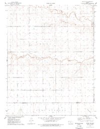
1976 Map of Modoc SW
USGS Topo · Published 1978About this map
The arid high plains of western Kansas are defined by ephemeral drainage patterns and isolated markers of community life in this mid-1970s survey. White Woman Creek meanders across the northern section of the map, mirrored by the seasonal course of Sand Creek further south. These waterways, alongside Crozier Draw, shape a landscape otherwise divided by the precise geometry of the township and range system. Near the southern boundary, where Wichita County meets Kearny County, local heritage is anchored by the Lydia Ch and a nearby Cem. The map also indicates early industrial activity with a Gravel Pit located near the northern breaks of the terrain. The presence of these landmarks among the extensive Leoti and East Hibbard divisions illustrates the persistent footprint of rural settlement in a region dominated by vast open spaces.
Find a feature on this map
11 named features on this map. Tap any name to fly to it.
Don’t see what you’re looking for? This feature index may not catch every label — zoom into the map to look around manually.
Map Details
Editions of this 1976 Modoc SW Map
This is the sole edition of this map. No revisions or reprints were ever made.
Other maps of this area

1941 · Modoc
USGS Topo · 1:62,500

1951 · Modoc
USGS Topo · 1:62,500

1955 · Scott City
USGS Topo · 1:250,000

1958 · Scott City
USGS Topo · 1:250,000

1965 · Leoti 3 NE
USGS Topo · 1:24,000

1965 · Wolf NW
USGS Topo · 1:24,000

1965 · Wolf NE
USGS Topo · 1:24,000

1970 · Leoti
USGS Topo · 1:24,000

1970 · Lydia
USGS Topo · 1:24,000
1976 · Modoc SE
USGS Topo · 1:24,000